Bird’s Eye View of Port Phillip and Corio Bay
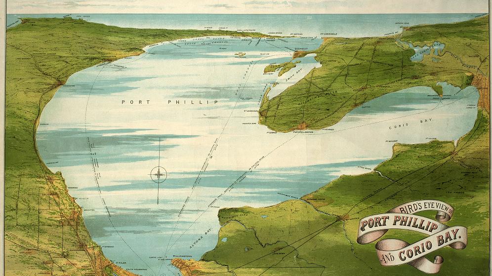
This 1890s map can be found in the Library’s rare and historical maps collection. You can download a larger version of this map from our digital collections website: http://library.unimelb.edu.au/digitalcollections/cultural_and_special_collections/map_collections/
Categories
Leave a Reply