Rare Maps
The Rare and Historic Map Collection comprises 15,000 culturally significant maps, mostly covering Melbourne, Victoria and Australia, and is located within the University’s collection of 100,000 printed maps and aerial photos. Around 500 of the historic maps can be viewed online via the Collections website: www.lib.unimelb.edu.au/collections/maps/map-historical.html.
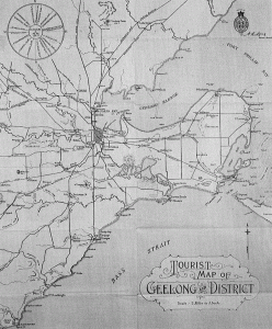
Top: ‘Tourist map of Geelong and District’, Melbourne: Department of Lands and Survey, W.J. Butson, 1924, University of Melbourne Library Map Collection. Other tourist maps made around this time were for places such as Ballarat, Dandenong Ranges and Buchan Caves.
Bottom: Martin Waldseemüller (1470-1521?) (after Ptolemy), ‘Tabvla Nova Asia Minoris’, Strasbourg: Published by Johann Schott, 1513, 34 x 47 cm, Walker Collection, University of Melbourne Library Map Collection. A hand-coloured map of Asia Minor using woodcut printing.
Categories


Leave a Reply